Digital Elevation Models
Common sources and vertical accuracy
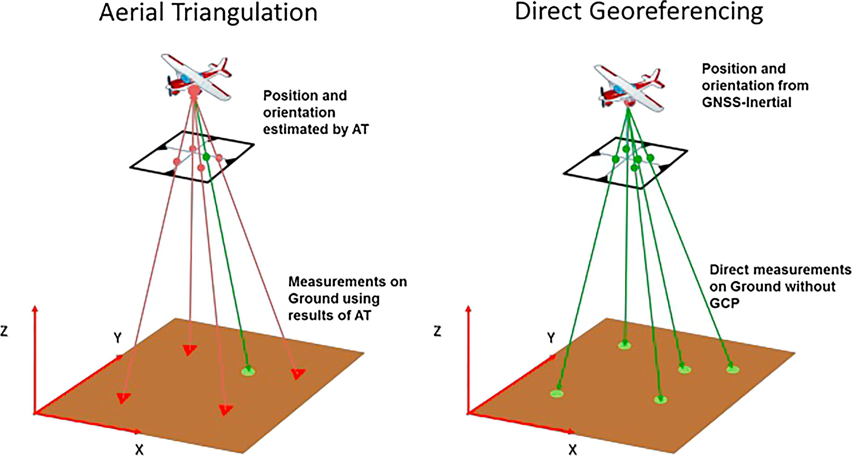
Triangulation versus direct Georeferencing, from Rabah et al.

DEMs: spatial resolution and vertical accuracy for different RS techniques and scales of application. From Schumann & Bates, 2018
In contrast to the Nilometer readings, 4000 years ago, from Hydrology in perspective, Dooge (1988).

DSM filtering to obtain DTM
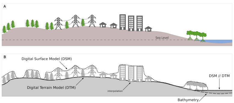
Digital Surface Model versus Terrain Model in “Terminology and Definitions for Digital Elevation Models”, Guth et al, 2021.
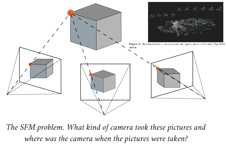
To understand how to transform a DSM from a Remote-Sensing device, as simple and affordable as a drone camera, in optical range (no LiDAR nor laser detection), we describe briefly the principles to generate a cloud of points from geo-referenced pictures (SfM: structure from motion), the 3D building of the surface model (dense multi-stereo matching) and the filtering with a SMRF (Simple Morphological Filter) to remove basically vegetation and blocks to work with bare earth.
Structure from motion principles and dense reconstruction

The workflow comes from the selected reference of Girod et al, 2017.
Filtering with SMRF windows

How a surface or a cloud of points is eroded with a SMRF filter using different slopes, or window height and length parameters, by Pingel et al, 2013. And how the parameters are tunned with smrf ODM-flags.
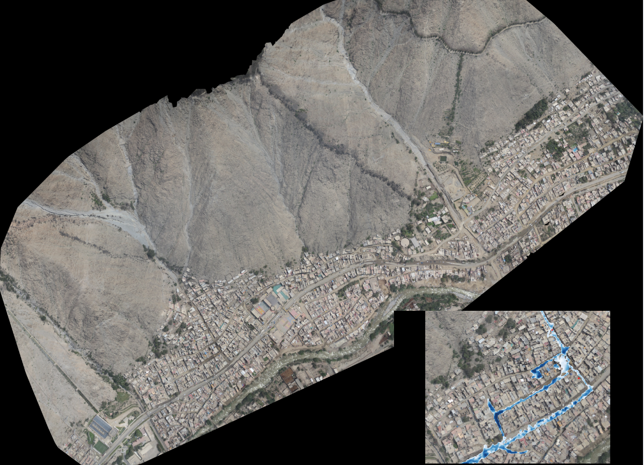
Training with affordable drones
In this section we practice with High-Quality drone imagery and the Open-Drone-Map software (ODM), to obtain DSMs and DTMs from simple flights to set the essential ground data for reliable simulations, at scales of a few hectares.
The basic documentation for processing a package of photographs from a drone flight can be reached at docs-opendronemap.
A repository with significant packages to start training, like the Carossio quebrada at Lima, Perú, IAPG-2022 training, will be available soon.